Climate Friendly Actions
The National Park Service, as one of the nation's leading resource stewardship agencies, is developing management practices that lead by setting a good example through conservation and education. Many parks are actively engaged in an array of green practices; other parks are just now getting on board. Here are some climate friendly activities we are undertaking.
1. Purchasing energy efficient products, such as ENERGY STAR® approved office equipment and light bulbs and provide guidelines for reducing energy consumption.
2. Converting to renewable energy sources such as solar or wind generated power.
3. Developing and utilizing "green" designs for construction of new or remodeled buildings.
4. Providing alternative transportation options for within-park commuting for staff and visitors, such as shuttle services or another form of alternate transportation for travel to and within the park.
5. Purchasing hybrid electric or propane-fueled vehicles for official use.
6. Using teleconferences or other forms of modern technology in place of travel to conferences and meetings.
7. Engaging partners and enlist their support (e.g., tribal neighboring agencies, private land-holders) in climate change discussions, responses, and mitigation.
8. Developing management guidelines for managing uncertainty surrounding climate change effects in parks. Incorporating anticipated climate change impacts, such as decreases in lake levels or changes in vegetation and wildlife, into management plans.
9. Actively engage in research and scientific study in parks.
10. Designing work projects around renewable energy, moving away from projects that rely solely on fossil fuel-based transportation and infrastructure.
11. Providing recycling options for solid waste and trash generated within the park.
12. Initiating restoration efforts as a means for enhancing species’ ability to cope with stresses and adapt to climatic and environmental changes. Through restoration of natural areas, we can lessen climate change impacts on species and their habitats. These efforts will help preserve biodiversity, natural resources, and recreational opportunities.
13. Restoring and conserving connectivity within habitats, protecting and enhancing instream flows for fish, and maintaining and developing access corridors to climate change refugia. Restoring natural hydrologic functions of coastal wetlands to help protect coastal areas against hurricanes and flooding.
14. Posting climate change information in easily accessible locations such as on bulletin boards and websites.
15. Training park employees and partners on the effects of climate change on resources.
16. Incorporating climate change research and information into interpretive products and making staff available to help visitors make the connection between reducing greenhouse gas emissions and resource stewardship.
Monday, May 03, 2010

Thursday, April 29, 2010
Sculpture Garden, Australia
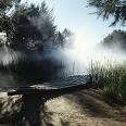
 Sculpture has most often been made to occupy open areas, in civic squares and in gardens, or to adorn the facades of buildings or mark sacred sites. The grounds that lie between the National Gallery of Australia and the shores of Lake Burley Griffin were configured to display the Gallery's extensive collection of sculpture.
This garden was planned and planted 22 years ago. Harry Howard and Associates and James Mollison, the first Director, designed this garden to complement the building. The diagonal of the main pathway and the floor plan of the garden repeats the triangular architecture of the main building.
Displayed in outside rooms are 26 sculptures made by International and Australian artists. Most of the sculptures were bought and placed in the garden during the early 1980s and reflect the abstract, industrial aesthetic of that time, however there are some works that are more evocative, for example the fog sculpture by Fujiko Nakaya and the Pukamani burial poles nearby.
The plants are native to Australia and were selected for their tolerance of Canberra's severe winter conditions and long hot dry summers. The seasons of the year form the main design structure with the Winter garden close to the building with warm winter slate and winter flowering acacias and the earliest figurative works of art. The Summer garden is the shady area beneath the Casaurinas and near the marsh pond. Tthe Spring garden, full of spring flowering Grevillias and Acacias is closer to the lake. The Autumn garden was never fully realised.
Wednesday, April 28, 2010
Turtle Island Park

Turtle Island Park consists of a number of uninhabited islands lying in the Sulu Sea, off the east coast of Sabah.The park comprises three small islands, Selingan, Gulisan and Bakungan Kechil. Selingan, the largest of the islands, houses the park's headquarters, a turtle hatchery, tourist accommodation and basic facilities. The other two islands are more for conservation activities.
Two species of turtles. Greens and Hawksbill are special festures of this park. Turtle landings usually occur after dusk. The park has a sensible policy of allowing visitors to see only one landing a night. This allows undisturbed nestings to go on throughout the night.
Whilst waiting for the evening's highlight, all that is left to do is to laze on the beach at sunset or snorkel. The west side of the island is ideal for this. It's clean, quiet, and offers some interesting coral and sea life. Wander around the island and you'll be surprised at how many turtles would have landed in the last few days; their tracks, like mini-tractors, remain in the sand for days.
The driest months and the calmest seas are between March and July. The peak egg laying season is July to October. The seas can get rough between October and February.
The nearest mainland town to the park is Sandakan. Your tour operator will organise a speedboat pick-up service to and from Turtle Island Park. It takes about one hours to reach the islands by boat.
Two species of turtles. Greens and Hawksbill are special festures of this park. Turtle landings usually occur after dusk. The park has a sensible policy of allowing visitors to see only one landing a night. This allows undisturbed nestings to go on throughout the night.
Whilst waiting for the evening's highlight, all that is left to do is to laze on the beach at sunset or snorkel. The west side of the island is ideal for this. It's clean, quiet, and offers some interesting coral and sea life. Wander around the island and you'll be surprised at how many turtles would have landed in the last few days; their tracks, like mini-tractors, remain in the sand for days.
The driest months and the calmest seas are between March and July. The peak egg laying season is July to October. The seas can get rough between October and February.
The nearest mainland town to the park is Sandakan. Your tour operator will organise a speedboat pick-up service to and from Turtle Island Park. It takes about one hours to reach the islands by boat.
Tuesday, April 27, 2010
Malaysia - PAYAR ISLAND

Payar Island, which comprises of four uninhabited islands - Payar, Lembu, Kaca and Segantang - makes up Malaysia's oldest Marine Park sanctuary.
These islands, famous for the varied and colourful marine life that they support, offer the best diving sites on Peninsular Malaysia's west coast. Access is not a problem as speedboats and catamarans ply the route on a regular basis from Langkawi and Penang.
At Payar Island, the largest of the four islands, you will find the Marine Park Centre which was set up and operated by the Fisheries Department. Here, you'll find useful information on the do's and don'ts while visiting this marine park.
If you are not into water activities, do check out the two hiking trails that have been constructed to enable visitors to explore and enjoy breathtaking views of the surrounding sea and beyond. Gazebos, picnic tables, BBQ pits and restroom facilities are also available for public use. Although picnics and camping are allowed, cutting of trees and open burning are strictly prohibited.
Nearby is a jetty, and just a short distance away is a pontoon with facilities for easy access to the reef below.The waters of Pulau Payar have an additional attraction -- artificial reefs built from tyres, concrete blocks and old boats, which over the years have developed into mature reefs that are teeming with marine life.
Wednesday, April 21, 2010
Gilgit Baltistan

The Northern Area is the most spectacular and fascinating region of Pakistan. It is here that the world's three famous mountain ranges meet - the Himalayas, the Karakorams and the Hindukush. The whole Northern Pakistan has come to be known as a paradise for mountaineers, climbers, trekkers, hikers and anglers of the most famous “Trout fish”.
In the northern regions of Pakistan, at a stone's throw from the Amu Darya, is” Bam-e-Dunya” (the roof of the world). This was the name given to the great Pamir plateau, apex of six of the mightiest mountain ranges of the world.
The historic Karakoram pass 5,575 metres, an ancient trading route between Kashmir and Xinjiang, gives its name to the range west of it that forms the watershed between the Indus and the Central Asian deserts. The eastern boundary of the Karakoram is the upper Shyok River from where it extends over 322 km. westwards to the Karumbar river and the Hindukush range. To the north the Shaksgam tributary of the Yarkand River and south by the Indus bound the Karakoram. Here, the Nanga Parbat 8,126 metres massif is the western anchor of the great Himalayan range which stretches in an arc 24,124 km. east to Burma, a boundary and barrier, "the razor's edge" which for centuries has determined the destiny of the Indian sub-continent.
Such is the setting of Karakoram Range, this remnant of a primeval ice age, "the third pole," with extensive glacier systems and the greatest concentration of lofty mountains in the world. Some of the largest glaciers outside sub-polar regions flow in the Karakorams. For its sheer mountain grandeur and breath-taking panorama of beauty, few places can match the superb landscape through which the Karakoram Highway snakes. A fantastic and unforgettable spectacle is the passage of the Highway along the Baltura glacier, rated among the worlds seventh largest.
The Khunjerab Pass, which the Highway crosses, and the nearby Mintaka Pass lie astride the fabulous ancient Silk Route that led from Europe to Asia and over which history's most famous tourists once travelled. These include the Venetian trader Marco Polo after who has been made the wild Marco Polo sheep in the thirteenth century, the Chinese Monk Fe Hien in the fourth century and the Arab historian, Al-Beruni in the eleventh century.
The Siachin glacier is 75 km, the Hispar, (52 km) joints the Biafo at the Hispar La 5,154 metres to form an ice corridor, 116 km. long.The Batura too is 58 km. in length. But the most outstanding of these rivers of ice is the Baltoro (62 km). This mighty glacier fed by some 30 tributaries constitutes a surface area of 1,219 sq. km. Of the fourteen over 8,000 m peaks on earth, four occupy an amphitheatre at the head of Baltoro. There are K-2 (8,611) second only to Everest, Broad Peak (8,047 metres) Gasherbrum-I (8,068 metres), Gasherbrum-II (8,035 metres).
Seen from a distance, the Baltoro appears smooth and beautiful but in fact it is a chaotic tumbling mass of rock and ice, troughs and hillocks and the debris of centuries.
It is a unique remote corner of earth. For here, in a frozen wilderness a crag, cornices and crevasses, raise towering spires of granite, great snowy peaks with fluted icy ridges and pinnacles that pierce the sky.In the Lesser Karakorams there are equally great peaks such as Rakaposhi (7,788 metres), the dominant giant in Hunza valley. Its north face is fantastic precipice - 5,791 metres of plunging snow and ice.
There are scores of over 7,000 m peaks in the Karakoram Range and hundreds of nameless summits below 6,000 metres, mere points on the map. The shapes, forms, sizes, colours provide tremendous contrast, which defy description. K-2, the undisputed monarch of the sky, Broad Peak, massive and ugly, Muztagh Tower, deceptively, sheer. Gasherbrum-II, the "Egyptian Pyramid" that even Cheops would have preferred for a tomb, Chogolisa, the "Bride Peak", in whose eternal embrace lies Hermann Buhi, the first man to climb Nanga Parbat. The Cathedrals of the Baltoro with their great knife-edge ridges, the sky cleaving monoliths of the Trango Towers and most beautiful of all - the Peak of Perfection - Paiyu, (6,600 metres) first climbed by a Pakistani expedition in 1977.
The Hindukush is also a mountain vastness containing hundreds of peaks, many above 7,000 metres including a Trichmir 7,705 metre that is the highest point of the range
In the northern regions of Pakistan, at a stone's throw from the Amu Darya, is” Bam-e-Dunya” (the roof of the world). This was the name given to the great Pamir plateau, apex of six of the mightiest mountain ranges of the world.
The historic Karakoram pass 5,575 metres, an ancient trading route between Kashmir and Xinjiang, gives its name to the range west of it that forms the watershed between the Indus and the Central Asian deserts. The eastern boundary of the Karakoram is the upper Shyok River from where it extends over 322 km. westwards to the Karumbar river and the Hindukush range. To the north the Shaksgam tributary of the Yarkand River and south by the Indus bound the Karakoram. Here, the Nanga Parbat 8,126 metres massif is the western anchor of the great Himalayan range which stretches in an arc 24,124 km. east to Burma, a boundary and barrier, "the razor's edge" which for centuries has determined the destiny of the Indian sub-continent.
Such is the setting of Karakoram Range, this remnant of a primeval ice age, "the third pole," with extensive glacier systems and the greatest concentration of lofty mountains in the world. Some of the largest glaciers outside sub-polar regions flow in the Karakorams. For its sheer mountain grandeur and breath-taking panorama of beauty, few places can match the superb landscape through which the Karakoram Highway snakes. A fantastic and unforgettable spectacle is the passage of the Highway along the Baltura glacier, rated among the worlds seventh largest.
The Khunjerab Pass, which the Highway crosses, and the nearby Mintaka Pass lie astride the fabulous ancient Silk Route that led from Europe to Asia and over which history's most famous tourists once travelled. These include the Venetian trader Marco Polo after who has been made the wild Marco Polo sheep in the thirteenth century, the Chinese Monk Fe Hien in the fourth century and the Arab historian, Al-Beruni in the eleventh century.
The Siachin glacier is 75 km, the Hispar, (52 km) joints the Biafo at the Hispar La 5,154 metres to form an ice corridor, 116 km. long.The Batura too is 58 km. in length. But the most outstanding of these rivers of ice is the Baltoro (62 km). This mighty glacier fed by some 30 tributaries constitutes a surface area of 1,219 sq. km. Of the fourteen over 8,000 m peaks on earth, four occupy an amphitheatre at the head of Baltoro. There are K-2 (8,611) second only to Everest, Broad Peak (8,047 metres) Gasherbrum-I (8,068 metres), Gasherbrum-II (8,035 metres).
Seen from a distance, the Baltoro appears smooth and beautiful but in fact it is a chaotic tumbling mass of rock and ice, troughs and hillocks and the debris of centuries.
It is a unique remote corner of earth. For here, in a frozen wilderness a crag, cornices and crevasses, raise towering spires of granite, great snowy peaks with fluted icy ridges and pinnacles that pierce the sky.In the Lesser Karakorams there are equally great peaks such as Rakaposhi (7,788 metres), the dominant giant in Hunza valley. Its north face is fantastic precipice - 5,791 metres of plunging snow and ice.
There are scores of over 7,000 m peaks in the Karakoram Range and hundreds of nameless summits below 6,000 metres, mere points on the map. The shapes, forms, sizes, colours provide tremendous contrast, which defy description. K-2, the undisputed monarch of the sky, Broad Peak, massive and ugly, Muztagh Tower, deceptively, sheer. Gasherbrum-II, the "Egyptian Pyramid" that even Cheops would have preferred for a tomb, Chogolisa, the "Bride Peak", in whose eternal embrace lies Hermann Buhi, the first man to climb Nanga Parbat. The Cathedrals of the Baltoro with their great knife-edge ridges, the sky cleaving monoliths of the Trango Towers and most beautiful of all - the Peak of Perfection - Paiyu, (6,600 metres) first climbed by a Pakistani expedition in 1977.
The Hindukush is also a mountain vastness containing hundreds of peaks, many above 7,000 metres including a Trichmir 7,705 metre that is the highest point of the range
Wednesday, April 14, 2010
Health Tip: Tour Wisely
* Examine your hotel or motel for potential hazards, such as sharp corners on furniture, unprotected electrical outlets or shaky balcony railings.
* Allow children to take regular naps, as they normally would at home.
* Bring clothing that's weather-appropriate to make sure you and your family are protected and comfortable.
* Prevent sunburn by having all family members apply sunscreen. Also, avoid prolonged exposure to the sun when it's hottest between 10 a.m. and 4 p.m.
* Make sure water is safe for swimming.
* Keep children away from unfamiliar animals.
* Make sure hands and toys are washed frequently with soap and water.
* To prevent ear discomfort while on a plane, provide young children with a pacifier or bottle. Bigger kids and adult can chew some gum.
* Allow children to take regular naps, as they normally would at home.
* Bring clothing that's weather-appropriate to make sure you and your family are protected and comfortable.
* Prevent sunburn by having all family members apply sunscreen. Also, avoid prolonged exposure to the sun when it's hottest between 10 a.m. and 4 p.m.
* Make sure water is safe for swimming.
* Keep children away from unfamiliar animals.
* Make sure hands and toys are washed frequently with soap and water.
* To prevent ear discomfort while on a plane, provide young children with a pacifier or bottle. Bigger kids and adult can chew some gum.
Tuesday, March 30, 2010
Top 10 places to see when you visit Penang
All the major heritage buildings
and clanhouses in the George Town
inner city!
Be impressed by the unique charms of Straits eclectic architecture and colonial past that has earned George Town a place in Unesco’s heritage site listing and be humbled by the grandeur of a priceless religious and cultural legacy - here, every building represents a page of our history and every street corner has a tale to tell.
Thee Kong Tua (Jade Emperor’s Temple)
in Air Itam
The Jade Emperor's Pavilion is a stone’s throw away from Kek Lok Si and Penang Hill Railway Station in Air Itam. The temple is dedicated to the Jade Emperor, who according Taoist believe, is the supreme ruler of heaven. This temple is the only one in the country built specifically for devotees to pay homage to Thee Kong.
After undergoing massive renovation work, the 140-year-old temple is applying for Unesco heritage conservation recognition. During Chinese New Year, devotees throng the temple to pay homage to the deity on his birthday (which falls on the ninth day of the celebration).
Penang Hill
At 821m above sea level,Penang Hill visitors will be privy to some of the grandest colonial mansions (which are now restaurants and guests houses) while enjoying the cool, refreshing air and bird’s eye view of the island.
The hill (originally known as Strawberry Hill) was first cleared by Captain Francis Light (who first established Penang as a British colony) to plant strawberries – hence its original name.
Kek Lok Si Temple
Construction for the temple started in 1890 and to date, is the largest Buddhist temple in Malaysia. Known as the Temple of Supreme Bliss, Kek Lok Si ranks as among the best known temples in the region. Overlooking the town of Air Itam, the best time to visit Kek Lok Si is during Chinese New Year because thousands of lights are switched on to mark the celebration, transforming the place of worship into a brightly-lit fairyland at night.
Reclining Buddha
Located in the quaint Pulau Tikus town, Wat Chayamangkalaram was built in 1845 by a Thai Buddhist monk. It houses a 33-meter gold-plated reclining Buddha that attracts devotees from all over the world (especially during the Sonkran and the Loy Krathong festivals). Dragons, mythical serpents, elaborately decorated shrines and Buddha statues of all shapes and sizes dot the temple grounds.
A small Malaysian-Thai community lives around this temple. Right opposite Wat Chayamangkalaram is the Dharmikarama Burmese Temple.
National Park (Muka Head)
While Penang’s National Park in Pantai Acheh may be the smallest in the country, it is by no means less impressive. Eco-attractions like the pristine Pantai Kerachut beach and meromictic lake (a body of sea water and fresh water that do not mix) provide the perfect spot for picnics and fishing, swimming and trekking. Boat rides can also be arranged or those who want to visit the nearby islands. Also, do look out for the old lighthouse which was built in 1883 – it is still operational and visitors are welcome!
Toy Museum
The Penang Toy Museum in Tanjung Bunga is no kid’s play! With more than 100,000 toys, dolls, models and other fun collectibles, it is the largest museum of its kind anywhere in the world and the first in Asia. Featuring life-size models of super heroes to tiny action figures, this is one playground both kids and adults won’t want to miss!
Tropical Spice Garden (it’s the only
spice garden in South East Asia)
Having the distinction as being South East Asia’s only dedicated spice sanctuary, the Tropical Spice Garden in Teluk Bahang is indeed paradise on earth. Nestled among lush green foliage, exotic ferns and flowering plants, the garden’s café overlooks the pristine blue sea and is the ideal setting for an afternoon drink. Spread over a sprawling 3.2ha, the garden boasts of more than 500 varieties of flora from Malaysia and other regions.
Oh, and the souvenir shop is a one-of-a-kind boutique that carries some very interesting items made from the most popular local spices!
Snake Temple
The Chor Soo Kong Temple (as it is known among locals), is “guarded” by green Wagler Pitt Vipers believed to have slithered to the temple to protect the deity. Although these snakes are believed to have been rendered harmless by the sacred joss stick smoke and incense, their venom has been removed so visitors can heave a sigh of relief!
Butterfly farm
This tropical butterfly farm in Teluk Bahang is so famous that it was visited by former British Prime Minister Tony Blair and his wife when they came to Penang for a private holiday in 2008. A live museum with winged beauties fluttering about as well as a breeding research centre, the farm is an eco-tourism gem indeed.
inner city!
Be impressed by the unique charms of Straits eclectic architecture and colonial past that has earned George Town a place in Unesco’s heritage site listing and be humbled by the grandeur of a priceless religious and cultural legacy - here, every building represents a page of our history and every street corner has a tale to tell.
Thee Kong Tua (Jade Emperor’s Temple)
in Air Itam
The Jade Emperor's Pavilion is a stone’s throw away from Kek Lok Si and Penang Hill Railway Station in Air Itam. The temple is dedicated to the Jade Emperor, who according Taoist believe, is the supreme ruler of heaven. This temple is the only one in the country built specifically for devotees to pay homage to Thee Kong.
After undergoing massive renovation work, the 140-year-old temple is applying for Unesco heritage conservation recognition. During Chinese New Year, devotees throng the temple to pay homage to the deity on his birthday (which falls on the ninth day of the celebration).
Penang Hill
At 821m above sea level,Penang Hill visitors will be privy to some of the grandest colonial mansions (which are now restaurants and guests houses) while enjoying the cool, refreshing air and bird’s eye view of the island.
The hill (originally known as Strawberry Hill) was first cleared by Captain Francis Light (who first established Penang as a British colony) to plant strawberries – hence its original name.
Kek Lok Si Temple
Construction for the temple started in 1890 and to date, is the largest Buddhist temple in Malaysia. Known as the Temple of Supreme Bliss, Kek Lok Si ranks as among the best known temples in the region. Overlooking the town of Air Itam, the best time to visit Kek Lok Si is during Chinese New Year because thousands of lights are switched on to mark the celebration, transforming the place of worship into a brightly-lit fairyland at night.
Reclining Buddha
Located in the quaint Pulau Tikus town, Wat Chayamangkalaram was built in 1845 by a Thai Buddhist monk. It houses a 33-meter gold-plated reclining Buddha that attracts devotees from all over the world (especially during the Sonkran and the Loy Krathong festivals). Dragons, mythical serpents, elaborately decorated shrines and Buddha statues of all shapes and sizes dot the temple grounds.
A small Malaysian-Thai community lives around this temple. Right opposite Wat Chayamangkalaram is the Dharmikarama Burmese Temple.
National Park (Muka Head)
While Penang’s National Park in Pantai Acheh may be the smallest in the country, it is by no means less impressive. Eco-attractions like the pristine Pantai Kerachut beach and meromictic lake (a body of sea water and fresh water that do not mix) provide the perfect spot for picnics and fishing, swimming and trekking. Boat rides can also be arranged or those who want to visit the nearby islands. Also, do look out for the old lighthouse which was built in 1883 – it is still operational and visitors are welcome!
Toy Museum
The Penang Toy Museum in Tanjung Bunga is no kid’s play! With more than 100,000 toys, dolls, models and other fun collectibles, it is the largest museum of its kind anywhere in the world and the first in Asia. Featuring life-size models of super heroes to tiny action figures, this is one playground both kids and adults won’t want to miss!
Tropical Spice Garden (it’s the only
spice garden in South East Asia)
Having the distinction as being South East Asia’s only dedicated spice sanctuary, the Tropical Spice Garden in Teluk Bahang is indeed paradise on earth. Nestled among lush green foliage, exotic ferns and flowering plants, the garden’s café overlooks the pristine blue sea and is the ideal setting for an afternoon drink. Spread over a sprawling 3.2ha, the garden boasts of more than 500 varieties of flora from Malaysia and other regions.
Oh, and the souvenir shop is a one-of-a-kind boutique that carries some very interesting items made from the most popular local spices!
Snake Temple
The Chor Soo Kong Temple (as it is known among locals), is “guarded” by green Wagler Pitt Vipers believed to have slithered to the temple to protect the deity. Although these snakes are believed to have been rendered harmless by the sacred joss stick smoke and incense, their venom has been removed so visitors can heave a sigh of relief!
Butterfly farm
This tropical butterfly farm in Teluk Bahang is so famous that it was visited by former British Prime Minister Tony Blair and his wife when they came to Penang for a private holiday in 2008. A live museum with winged beauties fluttering about as well as a breeding research centre, the farm is an eco-tourism gem indeed.
Wednesday, March 24, 2010
Visit the white house

White House History
For more than 200 years, the White House has been more than just the home of the Presidents and their families. Throughout the world, it is recognized as the symbol of the President, of the President's administration, and of the United States.
About the Building
For two hundred years, the White House has stood as a symbol of the Presidency, the United States government, and the American people. Its history, and the history of the nation's capital, began when President George Washington signed an Act of Congress in December of 1790 declaring that the federal government would reside in a district "not exceeding ten miles square…on the river Potomac." President Washington, together with city planner Pierre L’Enfant, chose the site for the new residence, which is now 1600 Pennsylvania Avenue. As preparations began for the new federal city, a competition was held to find a builder of the "President’s House." Nine proposals were submitted, and Irish-born architect James Hoban won a gold medal for his practical and handsome design.
Construction began when the first cornerstone was laid in October of 1792. Although President Washington oversaw the construction of the house, he never lived in it. It was not until 1800, when the White House was nearly completed, that its first residents, President John Adams and his wife, Abigail, moved in. Since that time, each President has made his own changes and additions. The White House is, after all, the President’s private home. It is also the only private residence of a head of state that is open to the public, free of charge.
The White House has a unique and fascinating history. It survived a fire at the hands of the British in 1814 (during the war of 1812) and another fire in the West Wing in 1929, while Herbert Hoover was President. Throughout much of Harry S. Truman’s presidency, the interior of the house, with the exception of the third floor, was completely gutted and renovated while the Trumans lived at Blair House, right across Pennsylvania Avenue. Nonetheless, the exterior stone walls are those first put in place when the White House was constructed two centuries ago.
Presidents can express their individual style in how they decorate some parts of the house and in how they receive the public during their stay. Thomas Jefferson held the first Inaugural open house in 1805. Many of those who attended the swearing-in ceremony at the U.S. Capitol simply followed him home, where he greeted them in the Blue Room. President Jefferson also opened the house for public tours, and it has remained open, except during wartime, ever since. In addition, he welcomed visitors to annual receptions on New Year’s Day and on the Fourth of July. In 1829, a horde of 20,000 Inaugural callers forced President Andrew Jackson to flee to the safety of a hotel while, on the lawn, aides filled washtubs with orange juice and whiskey to lure the mob out of the mud-tracked White House.
After Abraham Lincoln’s presidency, Inaugural crowds became far too large for the White House to accommodate them comfortably. However, not until Grover Cleveland’s first presidency did this unsafe practice change. He held a presidential review of the troops from a flag-draped grandstand built in front of the White House. This procession evolved into the official Inaugural parade we know today. Receptions on New Year’s Day and the Fourth of July continued to be held until the early 1930s.
* There are 132 rooms, 35 bathrooms, and 6 levels in the Residence. There are also 412 doors, 147 windows, 28 fireplaces, 8 staircases, and 3 elevators.
* At various times in history, the White House has been known as the "President's Palace," the "President's House," and the "Executive Mansion." President Theodore Roosevelt officially gave the White House its current name in 1901.
* Presidential Firsts while in office... President James Polk (1845-49) was the first President to have his photograph taken... President Theodore Roosevelt (1901-09) was not only the first President to ride in an automobile, but also the first President to travel outside the country when he visited Panama... President Franklin Roosevelt (1933-45) was the first President to ride in an airplane.
* With five full-time chefs, the White House kitchen is able to serve dinner to as many as 140 guests and hors d'oeuvres to more than 1,000.
* The White House requires 570 gallons of paint to cover its outside surface.
* For recreation, the White House has a variety of facilities available to its residents, including a tennis court, jogging track, swimming pool, movie theater, and bowling lane.
For more than 200 years, the White House has been more than just the home of the Presidents and their families. Throughout the world, it is recognized as the symbol of the President, of the President's administration, and of the United States.
About the Building
For two hundred years, the White House has stood as a symbol of the Presidency, the United States government, and the American people. Its history, and the history of the nation's capital, began when President George Washington signed an Act of Congress in December of 1790 declaring that the federal government would reside in a district "not exceeding ten miles square…on the river Potomac." President Washington, together with city planner Pierre L’Enfant, chose the site for the new residence, which is now 1600 Pennsylvania Avenue. As preparations began for the new federal city, a competition was held to find a builder of the "President’s House." Nine proposals were submitted, and Irish-born architect James Hoban won a gold medal for his practical and handsome design.
Construction began when the first cornerstone was laid in October of 1792. Although President Washington oversaw the construction of the house, he never lived in it. It was not until 1800, when the White House was nearly completed, that its first residents, President John Adams and his wife, Abigail, moved in. Since that time, each President has made his own changes and additions. The White House is, after all, the President’s private home. It is also the only private residence of a head of state that is open to the public, free of charge.
The White House has a unique and fascinating history. It survived a fire at the hands of the British in 1814 (during the war of 1812) and another fire in the West Wing in 1929, while Herbert Hoover was President. Throughout much of Harry S. Truman’s presidency, the interior of the house, with the exception of the third floor, was completely gutted and renovated while the Trumans lived at Blair House, right across Pennsylvania Avenue. Nonetheless, the exterior stone walls are those first put in place when the White House was constructed two centuries ago.
Presidents can express their individual style in how they decorate some parts of the house and in how they receive the public during their stay. Thomas Jefferson held the first Inaugural open house in 1805. Many of those who attended the swearing-in ceremony at the U.S. Capitol simply followed him home, where he greeted them in the Blue Room. President Jefferson also opened the house for public tours, and it has remained open, except during wartime, ever since. In addition, he welcomed visitors to annual receptions on New Year’s Day and on the Fourth of July. In 1829, a horde of 20,000 Inaugural callers forced President Andrew Jackson to flee to the safety of a hotel while, on the lawn, aides filled washtubs with orange juice and whiskey to lure the mob out of the mud-tracked White House.
After Abraham Lincoln’s presidency, Inaugural crowds became far too large for the White House to accommodate them comfortably. However, not until Grover Cleveland’s first presidency did this unsafe practice change. He held a presidential review of the troops from a flag-draped grandstand built in front of the White House. This procession evolved into the official Inaugural parade we know today. Receptions on New Year’s Day and the Fourth of July continued to be held until the early 1930s.
* There are 132 rooms, 35 bathrooms, and 6 levels in the Residence. There are also 412 doors, 147 windows, 28 fireplaces, 8 staircases, and 3 elevators.
* At various times in history, the White House has been known as the "President's Palace," the "President's House," and the "Executive Mansion." President Theodore Roosevelt officially gave the White House its current name in 1901.
* Presidential Firsts while in office... President James Polk (1845-49) was the first President to have his photograph taken... President Theodore Roosevelt (1901-09) was not only the first President to ride in an automobile, but also the first President to travel outside the country when he visited Panama... President Franklin Roosevelt (1933-45) was the first President to ride in an airplane.
* With five full-time chefs, the White House kitchen is able to serve dinner to as many as 140 guests and hors d'oeuvres to more than 1,000.
* The White House requires 570 gallons of paint to cover its outside surface.
* For recreation, the White House has a variety of facilities available to its residents, including a tennis court, jogging track, swimming pool, movie theater, and bowling lane.
Thursday, March 18, 2010
Visit Cloghy Rocks Nature Reserve
 As the Strangford Lough tide ebbs, seals haul out to rest on this group of rocks. Both Common and Grey seals may be easily viewed. Common seals favour the site for breeding, with pups being born in July. Energetic displays by males can be seen prior to mating in August.
The reserve covers a large area of foreshore between the high and low water marks. The variety of habitats, from rocks to fine mud are home to many small shellfish and worms, providing a rich feeding ground for shore birds.
picture of a grey heron stalking preyOystercatchers, redshank and other wading birds feed as the tide falls and later roost on the rocks and islands still exposed at high tide.
Grey herons stand motionless for long periods, waiting to catch small fish or shore crabs. Mute swans nest on the adjacent islands. In the summer, common and sandwich terns dive for fish in the Strangford Narrows.
The pale-bellied brent geese, so numerous in the north of the lough in early winter, appear here in March to graze eel-grass on the mud-flats.

Dense growths of brown seaweeds occur with clearly defined zones of different species running down the shore levels, from channelled wrack at the top to kelp at the lowest part of the shore. In summer, an edible red seaweed called dulse is harvested from around the rocks.
Monday, March 15, 2010
DIVING IN ANDAMAN
 There is no adventure than diving. Whether you are novice, or whether you were been diving for so many years, there is always something new, fascinating or challenging about venturing into the underwater world. Your mind may be mesmerized by clouds of colourfull fish, your curiosity raised by the mysterious remains of sunken ships or your creativity awakened by the art of underwater photography. Your diving interests may range from a casual pastime pursued on vacation, to a constant passion, or even a career. Diving offers something new for everyone.
Diving in Andamans is a unique lifetime experience. The coastal water surrounding theses islands is the abode of one of the richest coral reef ecosystem is the world. The specialty is that, here the coral reefs and underwater formations are undamaged by human activity. The best season for diving is from December to April.
Many of the islands are surrounded by fringing reefs, often several hundred meters wide and separated from the shore by a lagoon of similar width. There are also more steeply undulating hills of raven volcanic lava, which makes for some unusual diving.
 There are plenty of steeply sloping and shallow reefs suitable for snorkeling.Large pelagics are plentiful in these waters, as are a variety of sharks. Large schools of hammerhead often patrol the waters away from the reefs and Grey, Whitetip, Nurse and leopard sharks are found closer inshore. Silvertip and Ocean Whitetips also sometimes appear out of the deep blue beyond. Enormous manta Rays are also often seen.
Few dive sites near to South Andaman Island/Port Blair
Cinque Island One of the best dive destinations in the island, it has clear emerald water with a visibility of upto 80 feet. The deep dive offers a terrific variety of marine life, including black coral, sightings of sharks and is ideal for the experienced diver.
North Point: This site at Cinque Island is mostly highlighted by sponges and small corals and diversity of fish life.
Fish Rock near Passage Island offers an extremely colourful dive. The topography consists of rocky slopes, boulders and drop-offs, featuring large fan of corals and plenty of sponges, Below 25m, the rocks are covered in small bushy soft corals in numerous hues. Hard corals are not so evident. Grey and Whitetip Reef and Reef Sharks are almost always in the vicinity as are Nurse Sharks. Among the rest of the marine life are Eagle rays. Potato Cod, large coral groupers, fusiliers, suitlips, turtles, batfish, bumphead. Parrotfish,Squrielfish, curious and friendly oriental sweetlips, surgeonfish, yellow Tangs, Triggerfisk, tuna, Rainbow runners and many spices of trevally.
Bala Reef: On the western side of little Andaman, Bala Reef spreads over 4-5 sq.km amd is said to be one of the best sites in the Anadamans for coral-with vibrant colours.
Snake Island off Corbyn’s Cove beach. This site offers awesome rock faces and spectacular dive landscape. Marine life includes Trigger fish, Grunts, Goatfish and Rays.
Corruption Rock : Corruption Rock sticks out between Chidiyatapu and Rutland Island. The dive site is on the western side of the rock and is made up of big underwater boulders. The corals are not brilliant but the craggy undersea landscape of boulders is stunning. A fantastic wonderland of gullies, channels , ridges and canyons. Look out for giant napoleons and eagle rays, huge snappers, schooling fusiliers, banner and unicorn fish, Dolphins, tuna and reef sharks have also been sighted here.
Rutland Island: The shallow waters near to the island have a good representation of most smaller fish and coral, and a good place for training open water divers. There is a ship wreck site also.
Havelock Island: This is located approximately 50kms from Port Blair by inter-island ferry. There is a range of largely unexplored dive sites rich in underwater marine life.
Dive sites near to the Havelock Island
Mac Point Mostly hardcorales and their inhabitants are found. Usually good visibility, dugongs have been spotted here.
Aquarium is a fringing reef with lots of ‘fishtraffic’. Usually good visibility, mostly hardcorales.
Barracuda City Tons of fish, sometimes turtles, mostly hard and some soft corals. Rather suitable for experienced divers.
Turtle Bay is an easy pleasant dive site not exceeding 14 meters. Rays are found in the sand and with luck turtles.
Seduction Point A huge rock with different kind of aquatic life. Napoleans can be seen. The shallow part is full with staghorn corals and its inhabitants.
Lighthouse is a huge divesite, suitable for any kind of dives. Huge variety of soft and hard corals. Perfect for nightdives.
The Wall is a huge dive submerged rock. The wall drops down to a maximum of 55 meters and is full with life. Huge forests of softcorals plus schools of fish circling you, makes it always a memorable dive.
Pilot Reef near to Havelock is a huge block of prestine hardcorals. At the bottom(max 24 meters) ‘canyons’ are stretching out. Leopard and White Tip Sharks have been sighted.
Minerva ledge at Havelock is even bigger block of hard corals. Tons of fish even bigger block of hardcorals. Tons of fish, usually good visibility and the possibility of seeing sharks makes it one of the top dive sites.
Campbell Shoaloff North Button Island.
The bottom of this site is covered in mainly hardcorals, with sporadic sandy patches and hosts a multitude of reef animals. The marine life includes Whitetip Reef Sharks, large cod and groupers, Coral Trout, Blue and Golden-banded fusilers, Giant Trevally and a host of colourfull reef-fish.
Mahatma Gandhi Marine National Park, Wandoor Hundreds of colourfull varieties of coral reef fishes can be seen in the park. Some of these are clownfish, butterfly fish, surgeon fish, angel fish, parrot fish, bat fish and groupers. Whitetip shark, hammer headed shark, Manta ray and blue fin jack are also occasionally seen. More than 50 tyres of corals are found in the fringing type of coral reefs in the park. Some important coral varieties found here are Acropora, Pocillopora, Montipora, Leptoseris, Fungia, Portis, Tubipora and Gorgonians.
Thursday, March 11, 2010
Ellis Island, USA
 Ellis Island
Opened on January 1, 1892, Ellis Island became the nation's premier federal immigration station. In operation until 1954, the station processed over 12 million immigrant steamship passengers. The main building was restored after 30 years of abandonment and opened as a museum on September 10, 1990.
Today, over 40 percent of America's population can trace their ancestry through Ellis Island.
Monday, March 08, 2010
Kashi Vishwanath Temple, India

Varanasi, also known as Benaras and Kashi, is a major city in the north Indian state of Uttar Pradesh. Situated on the banks of the holy river Ganga, the city has great religious significance for the Hindus. Varanasi is home to Kashi Vishwanath Temple, which is dedicated to Lord Shiva. It enshrines one of the twelve Jyotirlingams of Shiva. It is said that this temple was rebuilt several times. The latest structure standing here dates back to the 18th century. Thousands of Pilgrims converge here to perform an abhishekam to the sacred Jyotirlingam, with water from the Ganga.
Beside its religious significance, the temple is also an architectural marvel. The magnificent edifice offers a breathtaking view to the onlooker. It is said that once Lord Shiva came in the dream of Rani Ahalya Bai Holkar of Indore. She, being a devotee of Lord Shiva, got the current temple built in 1777.
Vishwanath Khanda, also referred to as the Old City is located at the heart of Varanasi, between Dashashwamedha Ghat and Godaulia to the south and west and Manikarnika Ghat on the river to the north. The whole area rewards exploration, with numerous shrines and lingams tucked into every corner, and is buzzing with the activity of pilgrims, pandas and stalls selling offerings to the devotees.
Approached through a maze of narrow alleys and the Vishwanath Gali (or Lane), the temple complex of Vishwanath or Visheshwara, the "Lord of All", is popularly known as the Golden Temple, due to the massive gold plating on its shikhara (spire). Inside the compound, which is hidden behind a wall, and entered through an unassuming doorway, is one of India's most important shivalingams, made of smooth black stone and seated in a solid silver plinth. The shrines of the wrathful protectors Mahakala and Dandapani, and the lingam of Avimukteshvara are also situated within the temple complex.
Pilgrims offer their sankalpa or statement of intent here, before commencing the Panchatirthi Yatra. Slightly north, across the main road, the thirteenth-century Razia's Mosque stands atop the ruins of a still earlier Vishwanatha temple.
Varanasi is said to be the point at which the first jyotirlinga, the fiery pillar of light by which Shiva manifested his supremacy over other gods, broke through the earth's crust and flared towards the heavens. More than the Ghats and even the Ganga, the Shivalinga installed in the temple remain the devotional focus of Varanasi.
Beside its religious significance, the temple is also an architectural marvel. The magnificent edifice offers a breathtaking view to the onlooker. It is said that once Lord Shiva came in the dream of Rani Ahalya Bai Holkar of Indore. She, being a devotee of Lord Shiva, got the current temple built in 1777.
Vishwanath Khanda, also referred to as the Old City is located at the heart of Varanasi, between Dashashwamedha Ghat and Godaulia to the south and west and Manikarnika Ghat on the river to the north. The whole area rewards exploration, with numerous shrines and lingams tucked into every corner, and is buzzing with the activity of pilgrims, pandas and stalls selling offerings to the devotees.
Approached through a maze of narrow alleys and the Vishwanath Gali (or Lane), the temple complex of Vishwanath or Visheshwara, the "Lord of All", is popularly known as the Golden Temple, due to the massive gold plating on its shikhara (spire). Inside the compound, which is hidden behind a wall, and entered through an unassuming doorway, is one of India's most important shivalingams, made of smooth black stone and seated in a solid silver plinth. The shrines of the wrathful protectors Mahakala and Dandapani, and the lingam of Avimukteshvara are also situated within the temple complex.
Pilgrims offer their sankalpa or statement of intent here, before commencing the Panchatirthi Yatra. Slightly north, across the main road, the thirteenth-century Razia's Mosque stands atop the ruins of a still earlier Vishwanatha temple.
Varanasi is said to be the point at which the first jyotirlinga, the fiery pillar of light by which Shiva manifested his supremacy over other gods, broke through the earth's crust and flared towards the heavens. More than the Ghats and even the Ganga, the Shivalinga installed in the temple remain the devotional focus of Varanasi.
Thursday, March 04, 2010
The Royal Taj Mahal

A flawless architectural creation
For centuries, the Taj Mahal has inspired poets, painters and musicians to try and capture its elusive magic in word, colour and son. Since the 17th century, travellers have crossed continents to come and see this ultimate memorial to love, and few have been unmoved by its incomparable beauty.
Taj Mahal stands in the city of Agra, in the northern Indian state of Uttar Pradesh, on the banks of the Yamuna river. It was built in the memory of the beautiful Arjumand Bano Begum, who won the heart of a Mughal prince. She was married at 21 to Emperor Jahangir's third son Prince Khurram and stayed loyally by his side through good times and bad: in the luxurious royal palaces of Agra as well as the transient tents of war camps.
A memorial to his beloved
In AD 1628, Khurram became king after a bloody battle of succession; he took the name Shahjahan or King of the World and showered his beloved begum with the highest titles. She became Mumtaz Mahal, the Exalted of the Palace and Mumtaz-ul-Zamani, the Exalted of the Age. But Mumtaz Mahal was not destined to be queen for long.
In 1631, Shahjahan went on an expedition to the South and, as always, Mumtaz Mahal accompanied him. But she died in childbirth at Burhanpur. She had borne Shahjahan fourteen children, of whom four sons and three daughters survived. When Mumtaz Mahal died, she was just 39 years old. Shahjahan was inconsolable and contemporary chronicles tell of the royal court mourning for two years. There was no music, no feasting, and no celebration of any kind.
Shahjahan, who was a passionate builder, now decided to erect a memorial marble that the world would never forget. The site selected for the tomb was a garden by the Yamuna river, unshadowed by any other structure. The garden had been laid by Raja Man Singh of Amber and now belonged to his grandson, Raja Jai Singh. By a royal firman, Shahjahan gave Jai Singh four havelis in exchange for the garden. The site was also chosen because it was located on a bend in the river, and so could be seen from Shahjahan's personal palace in Agra Fort, further upstream.
A labour of love
Work on the mausoleum began in 1633 and 20,000 workers laboured for 17 years to build it. The most skilled architects, inlay craftsmen, calligraphers, stone-carvers and masons came from all across India and lands as distant as Persia and Turkey. The master mason was from Baghdad, an expert in building the double dome from Persia, and an inlay specialist from Delhi.
The tomb was completed in AD 1650. But, Shahjahan was deposed by his son Aurangzeb in 1658 and imprisioned in the Agra Fort. He spent his last years in the Mussalman Burj looking downstream at the Taj where his beloved Mumtaz Mahal lay. Sixteen years later he, too, was laid to rest beside her.
The bejewelled Palace
Shahjahan's two biggest passions were architecture and jewellery and both are reflected in the Taj Mahal. He visualised a building in marble and then had it decorated with semi-precious stones inlaid with the delicacy of handcrafted jewellery. Marble in purest white was brought from Makrana in Rajasthan, yellow marble and rockspar from the banks of the Narmada river, lack marble from Charkoh and red sandstone from Sikri. For the intricate pietra dura the finest gems were collected - crystal and jade from China, lapis lazuli and sapphires from Sri Lanka, jasper from Punja, carnelian from Baghdad and turquoise from Tibet.
Yemen sent agates, the corals came from Arabia, the garnets from Bundelkhand, onyx and amethyst from Persia. Mumtaz Mahal's final resting-place was ornamented like a queen's jewel-box.
The Complex
You enter the Taj complex through an arcaded forecourt where some of Shahjahan's other queens lie buried. The forecourt also has the Jilau Kana, a bazaar with cloisters leading to the main entrance of the tomb. The imposing gateway is made of red sandstone highlighted with marble and has octagonal kiosks on top. The gateway is an imposing 30 metres high and a fitting entrance to the Taj Mahal. The soaring arch is inscribed with a beautiful design of inlaid flowers and calligraphy.
As you enter the dark octagonal chamber under the gateway, the light streaming in from the opposite doorway draws you towards it. Here, framed by the arch of the doorway, the Taj Mahal reveals itself to the viewer with dramatic power. It stands at the end of a long walkway, framed by landscaped gardens and an ever-changing sky, its snowy marble glittering in the sunlight.
Taj Mahal stands at one side of a garden laid in the tradition charbagh style, with its square lawns bisected by pathways, water channels and rows of fountains. Halfway down the path there is a square pool, its limpid waters reflecting the marble tomb. Unlike other tombs, Taj Mahal stands at one end of the garden instead the centre. This was done deliberately, to leave its vista uncluttered by any other building.
The Main Building
The tomb stands on a marble plinth six-metres high. The four minarets at each corner beautifully frame the tomb. The plinth stands on a high standstone platform and at the far ends of this base are two identical sandstone structures, a mosque to the west and its jawab, or echo, to the east. This was the mehman khana or guesthouse. Thus, the main building is not just of great size but beautifully proportioned and balanced in design.
The octagonal central hall has four smaller octagonal halls round it and is decorated with magnificent inlay and dado panels done in high relief. The bulbous, perfectly-balanced double dome rises to a height of 45 metres and the four chhattris flanking and balancing the high drum give it added height. Taj Mahal rises 75 metres high and is, in fact, taller than the Qutb Minar.
An ornate marble screen, carved so fine that it almost has the texture of lace surrounds the cenotaphs in the central hall. However, as was the tradition during Mughal times, the actual graves lie in an underground crypt directly below the cenotaphs.
Intricacy in design
What is most amazing about the Taj Mahal is the fine detailing. The coloured inlay is never allowed to overwhelm the design, as carvings done in relief sensitively balance it. The ornate pietra dura and relief carvings are of floral, calligraphic and geometric designs. However, flowers remain the main decorative element as the tomb depicts a paradise garden. The skill of the inlay worker is so fine that it is impossible to find the joints, even when as many as 40 tiny pieces of semi-precious stones have been used in the petals of a single flower. Some of the best calligraphy of Koranic verses can be seen around the entrance arches and on the two headstones.
The colours of the Taj
Taj Mahal changes its moods with the seasons and the different times of the day. At dawn, the marble has a delicate bloom in shell pink, by noon it glitters majestically white, turning to a soft pearly grey at dusk. On full-moon away against the star-spangled sky. Monsoon clouds give it a moody blue tint and it appears and disappears like a mirage in the drifting mists of winter.
It can be solid and earthbound, fragile and ethereal, white, amber, grey and gold. The many faces of Taj Mahal display the seductive power of architecture at its best.
Wednesday, March 03, 2010
Saraswati Temple
Saraswati is the daughter of Brahma. Literally her name means 'the flowing one' .In the Rig Veda she represents a river deity and is connected with fertility and purification. She is considered the personification of all knowledge - arts, sciences, crafts and skills. She is the goddess of the creative impulse, the source of music, beauty and eloquence. Artists, writers and other individuals involved in creative endeavours have for millennia come on pilgrimage to Pushkar to invoke the inspiration of Brahma and Saraswati. According to a theory,the shrine myths are often metaphorical expressions of the particular power of a pilgrimage place, The lake, hill and area of Pushkar have a pervading spirit the presence of which awakens and stimulates the human capacity for creativity.
Wednesday, February 24, 2010
Wild Life sanctuaries

In spite of a comparatively hostile terrain, Rajasthan surprisingly is the abode of a number of mammals and birds. Its vast size and latitudinal variations above the sea level of 1,700m provides it with varied vegetation. It provides semi green forests of Mount Abu to dry grasslands of the desert, and from the dry deciduous thorn forest of Aravali to wetlands of Bharatpur.
The sanctuaries attract herds of species from all over to their temporary habitat that provides comfortable subsistence. During the season, the whole place echoes with enchanting sounds and fascinating visuals against the sprawling meadows of flora. Rajasthan is the haven of the tigers and many endangered species.
The leopard also called the panther here is found in forests and in open degraded forest areas with rocky outcrops adjoining towns and villages. The sneaky predator finds easy prey of unsuspecting village dogs, asses, calves and goats. There five lesser cats besides the two big cats. Besides a host of fauna there is a handsome variety of avian life too. Wetlands at Koeladeo Ghana Bird Sanctuary at Bharatpur are a bird watcher’s delight.
The sanctuaries attract herds of species from all over to their temporary habitat that provides comfortable subsistence. During the season, the whole place echoes with enchanting sounds and fascinating visuals against the sprawling meadows of flora. Rajasthan is the haven of the tigers and many endangered species.
The leopard also called the panther here is found in forests and in open degraded forest areas with rocky outcrops adjoining towns and villages. The sneaky predator finds easy prey of unsuspecting village dogs, asses, calves and goats. There five lesser cats besides the two big cats. Besides a host of fauna there is a handsome variety of avian life too. Wetlands at Koeladeo Ghana Bird Sanctuary at Bharatpur are a bird watcher’s delight.
Sunday, February 21, 2010
Banjara wall hanging

This marvellous art form emanated from one of the most colourful and vibrant tribes of the country. Banjara attire reflects the romantic aura and the free spirit of the Lambadas or the Banjaras or the Gypsies as they are variously called. Staying in communes, they still strive to preserve the fascinating traditions of their ancestors. Tattooed women, their hands weighed down by ivory bangles, create captivating mirror work. Banjara Apparel, with excessive mirror work and pleasing colour combinations, perfectly balanced and blended,is a treat to the eyes. The Choli and the Skirt intricately embroidered with beads and shells, attract the attention of many a foreigner. Despite their gradual absorption into the mainstream of life, the Banjaras still continue to keep in touch with their age-old customs, traditions and beliefs, An off-shoot of Banjara needlework is the fantastic range of artistic piecces like bags, belts batwas, skirts, blouses, bed apreads, sofa backs, cushion covers and many more utility objects that meet the changing tastes and requirements of present day connoisseurs. Such is the beauty and variety of Banjara works of art specifically on garments that it has also captured the imagination of the fashion world.
Monday, February 15, 2010
Pitalkhora Caves
Not as well known as Ajanta yet also interest are the rock-cut caves of Pitalkhora in the Satamala range of the Sahyadri hills. There are thirteen caves, set high up on the hill, overlooking picturesque ravines. Many of the caves contain carvings and paintings that date from the 1st century B.C. to the 5the century A.D. They were discovered after Ajanta and are first mentioned in a publication of 1853 where Caves 3 and 4 are described.
Many of the carvings as well as the paintings have been damaged by the weather and vandals. The caves appear to be of the early Hinayana period of Buddhism and are contemporary to the other rock-cut Buddhist temples in western India. They were probably excavated and carved during the Satavahana-Kshaharata regimes. There appears to be a subsequent period of desertion and re-occupation much later in the 5th century A.D. during the Vakataka rule. In the Hinayana Buddhist period no images of Buddha or Bodhisattvas (celestial beings personifying the virtues of Buddha and attending to the needs of the people) appear in places of worship and none can be seen in the caves of Pitalkhora except for the paintings in Cave 3, which belong to the later phase of occupation.
Because of their locations the caves have been divided into two groups. Caves 1-9 face north and east and are adjacent to each other. These are in Group I. On the other side of the hill, facing southwards are Caves 10-14 which make up Group II.

Many of the caves have crumbled and are badly damaged. Cave 1 looks like a huge natural opening. There are indications of cells and door supports and it may have formed an extensive Vihara or monastery.
Caves 2, 3 and 4 share the same forecourt and are presumed to be of the same period. The dividing wall between 2 and 3 has disappeared, 2 was a Vihara and has an interesting rock-cut drain which prevents water from flowing into Cave 3 which was a prayer hall.
The best paintings are in Cave 3. These appear on the pillars and side walls. 37 pillars used to separate the aisle from the hall and these were donated individually as inscriptions on the 10th and 11th pillars, on the right, indicate. The donors of both these pillars were residents of Paithan. Steps lead down to a basement containing several carvings. Rare crystals and other reliquaries were found in the stupa here.
Many of the carvings as well as the paintings have been damaged by the weather and vandals. The caves appear to be of the early Hinayana period of Buddhism and are contemporary to the other rock-cut Buddhist temples in western India. They were probably excavated and carved during the Satavahana-Kshaharata regimes. There appears to be a subsequent period of desertion and re-occupation much later in the 5th century A.D. during the Vakataka rule. In the Hinayana Buddhist period no images of Buddha or Bodhisattvas (celestial beings personifying the virtues of Buddha and attending to the needs of the people) appear in places of worship and none can be seen in the caves of Pitalkhora except for the paintings in Cave 3, which belong to the later phase of occupation.
Because of their locations the caves have been divided into two groups. Caves 1-9 face north and east and are adjacent to each other. These are in Group I. On the other side of the hill, facing southwards are Caves 10-14 which make up Group II.

Many of the caves have crumbled and are badly damaged. Cave 1 looks like a huge natural opening. There are indications of cells and door supports and it may have formed an extensive Vihara or monastery.
Caves 2, 3 and 4 share the same forecourt and are presumed to be of the same period. The dividing wall between 2 and 3 has disappeared, 2 was a Vihara and has an interesting rock-cut drain which prevents water from flowing into Cave 3 which was a prayer hall.
The best paintings are in Cave 3. These appear on the pillars and side walls. 37 pillars used to separate the aisle from the hall and these were donated individually as inscriptions on the 10th and 11th pillars, on the right, indicate. The donors of both these pillars were residents of Paithan. Steps lead down to a basement containing several carvings. Rare crystals and other reliquaries were found in the stupa here.
Wednesday, February 10, 2010
Dalhousie

Dalhousie (2036 m) is a hill station full of colonial charm that holds lingering echoes of the Raj. Spread out over the five hills (Kathlog, Potreys, Tehra, Bakrota and Balun) the town is named after the 19th century British Governer General Lord Dalhousie. It was popular with the British Army personnel in 1860's. The town’s varying altitude shades it with a variety of vegetation that includes stately grooves of pines, deodars, oaks and flowering rhododendrowns. Rich in colonial architecture, the town preserves some beautiful churches. St. John church is the oldest one built in 1863, St. Francis was built in 1894, St. Andrew in 1903 and St. Patric in 1909.
There are also magnificent views of Chamba valley and the mighty Dhauladhar range with its awe-inspiring snow covered peaks filling an entire horizon. By road Dalhousie is about 550 km from Delhi, 52 km from Chamba via Banikhet and 43 km via Khajjiar and the nearest railhead at Pathankot is 85 km away.
In & around Dalhousie the visitable places are:
Subash Baoli: Netaji Subhash Chandra Bose spent a large portion of 1937 contemplating here. A nice secluded place.
Panjpulla: It means five bridges. It is a picturesque spot with water flowing under the five small bridges. A samadhi of Sardar Ajit Singh, uncle of Bhagat Singh, adds to its importance. A small fresh water spring Satdhara is close by.
Bakrota hills: Visit for a brisk walk round the hills and have a view of snow clad peaks. It is 5 km from Dalhousie.
Kalatope: It is a picnic spot and a wild life sanctury, 10 km from Dalhousie and offers a fine view of the countryside.
Bara Pathar: It is 4 km from Dalhousie enroute Kalatope. In village Ahla here, there is atemple of Bhulwani Mata.
Dainkund: It is 10 km from Dalhousie. On a clear day this tall peak (2745 m) affords a birds eye-view of the hills, verdant valleys and the Beas, Ravi and Chenab rivers threading their silvery passage down to the plains.
There are also magnificent views of Chamba valley and the mighty Dhauladhar range with its awe-inspiring snow covered peaks filling an entire horizon. By road Dalhousie is about 550 km from Delhi, 52 km from Chamba via Banikhet and 43 km via Khajjiar and the nearest railhead at Pathankot is 85 km away.
In & around Dalhousie the visitable places are:
Subash Baoli: Netaji Subhash Chandra Bose spent a large portion of 1937 contemplating here. A nice secluded place.
Panjpulla: It means five bridges. It is a picturesque spot with water flowing under the five small bridges. A samadhi of Sardar Ajit Singh, uncle of Bhagat Singh, adds to its importance. A small fresh water spring Satdhara is close by.
Bakrota hills: Visit for a brisk walk round the hills and have a view of snow clad peaks. It is 5 km from Dalhousie.
Kalatope: It is a picnic spot and a wild life sanctury, 10 km from Dalhousie and offers a fine view of the countryside.
Bara Pathar: It is 4 km from Dalhousie enroute Kalatope. In village Ahla here, there is atemple of Bhulwani Mata.
Dainkund: It is 10 km from Dalhousie. On a clear day this tall peak (2745 m) affords a birds eye-view of the hills, verdant valleys and the Beas, Ravi and Chenab rivers threading their silvery passage down to the plains.
Sunday, February 07, 2010
Lu-ju Wu-fu Temple
Nan-kan Shieh of the Pinbu indigenous tribe used to reside in the area near Fu-tou Mountain, Wu-fu Village, Lu-ju Shiang. This area was the earliest settled area in Taoyuan County. According to legend, when Koxinga led his army to fight in northern Taiwan in the 16th year of Emperor Yung-li's reign (1661), his army was stationed here. His soldiers brought holy relics of Marshall Shien-tan with them, but forgot them in the camp. Then people discovered light emanating from this place. They believed it indicated the presence of a god, so they built a simple structure on the spot and worshiped there. Over time, more and more pilgrims came to pay their respects.
 This temple wasn't built until the 10th year of Emperor Chien-lung. The temple was first named Shien-tan Temple or Marshall Temple. Marshall Shien-tan refers to Gon-ming Chao, a loyal vassal during the Shang Dynasty. People respected him and called him Marshall Shien-tan Marshall. This area was prosperous owing to the god's blessing, so people called him Marshall Kai-tai (literally translated as Development of Taiwan).
This temple underwent renovations several times and became larger and larger each time. After reconstruction in the 6th year of Emperor Tung-chi Emperor (1867), this temple was named Wu-fu (literally translated as Five Fortunes) Temple. Sen-ji Pavilion was erected at the same time to promote literacy. This temple was last renovated in 1924. Now the temple is 3-rooms wide at the front and has three main buildings and two patios. Its wooden construction, woodcarvings, stone carvings, and Indochina pottery are marvelous. You may like to study it thoroughly. This temple has a long history and is classified as a grade three ancient site. It is now being repaired. It will be opened again in the near future.
Lu-ju Wu-fu TempleThe Sen-ji Pavilion in front of the temple is a 2-story building made of bricks. The opening of the furnace is on the bottom level. On both sides of the building are the stone tablets bearing the donors' names. There is a "Messenger's Cave" in the back hall. There are a lot of big snakes in the cave known as "heavenly snakes". People feed the snakes with eggs. The temple sponsors a parade on March 15 and birthday celebration for the master god on the 16th. These celebrations are fabulous activities for the temple. The temple also sponsors evidence ghost-month celebration on July 15, and floating lantern on the 14th, to be hosted by five major villages of Lu-ju Shiang. The activities are fabulous. Visitors are welcome to join the celebrations.
 This temple wasn't built until the 10th year of Emperor Chien-lung. The temple was first named Shien-tan Temple or Marshall Temple. Marshall Shien-tan refers to Gon-ming Chao, a loyal vassal during the Shang Dynasty. People respected him and called him Marshall Shien-tan Marshall. This area was prosperous owing to the god's blessing, so people called him Marshall Kai-tai (literally translated as Development of Taiwan).
This temple underwent renovations several times and became larger and larger each time. After reconstruction in the 6th year of Emperor Tung-chi Emperor (1867), this temple was named Wu-fu (literally translated as Five Fortunes) Temple. Sen-ji Pavilion was erected at the same time to promote literacy. This temple was last renovated in 1924. Now the temple is 3-rooms wide at the front and has three main buildings and two patios. Its wooden construction, woodcarvings, stone carvings, and Indochina pottery are marvelous. You may like to study it thoroughly. This temple has a long history and is classified as a grade three ancient site. It is now being repaired. It will be opened again in the near future.
Lu-ju Wu-fu TempleThe Sen-ji Pavilion in front of the temple is a 2-story building made of bricks. The opening of the furnace is on the bottom level. On both sides of the building are the stone tablets bearing the donors' names. There is a "Messenger's Cave" in the back hall. There are a lot of big snakes in the cave known as "heavenly snakes". People feed the snakes with eggs. The temple sponsors a parade on March 15 and birthday celebration for the master god on the 16th. These celebrations are fabulous activities for the temple. The temple also sponsors evidence ghost-month celebration on July 15, and floating lantern on the 14th, to be hosted by five major villages of Lu-ju Shiang. The activities are fabulous. Visitors are welcome to join the celebrations.
Thursday, February 04, 2010
Shell Beaches in India

The entire coastline of Andhra Pradesh is a good place for a shell collector's exploration tour, starting from Bheemunipatnam near Vishakhapatnam down to Mypad In Nellore District.
Situated 8-kms away from Vizag is another golden, unspoilt beach, Rishikonda, which attract tourists to visit its picturesque beach surroundings and make most of their beach holiday. The beaches of Pondicherry also provide a virgin setting; the golden yellow sand of the beach area is unpolluted, making this place and noteworthy pleasure and relaxation spot.
Mangalore's two beaches Taneerbhavi and Panambhoor are a delight to visit, or check out the coastal pilgrimage beach centres of Ganapatipulle in Maharashtra. One is rewarded with a varied choice of shells over here. Beyt Dwarka in Gujarat has some fine stretches of beach, though crowded by pilgrims; you can always find a quiet spot to relax.
Malpe in Karnataka is another coastal pilgrimage beach centres with a sheltered harbour making it a quiet beach retreat, just 6-kms away from Udupi, the temple town, renowned for a fascinating idol of Lord Krishna. Close to Malpe is Ullal, yet another beach resort, the silvery beaches of which command breathtaking views of the sunset, especially, when viewed through the Casuarina groves. Marwanthe beach is a very family kind of beach where one can come to in the evenings to just relax and let the smooth breeze caress you and tease your hair.
Still, the foremost shell collector's destinations are the islands of Lakshadweep and Andaman & Nicobar. The natural beauty has stayed unspoiled, as each island and beaches of Lakshadweep and Andaman and Nicobar has existed since time immemorial, with little influence from the outside world.
Other Shell Beaches:
Situated 8-kms away from Vizag is another golden, unspoilt beach, Rishikonda, which attract tourists to visit its picturesque beach surroundings and make most of their beach holiday. The beaches of Pondicherry also provide a virgin setting; the golden yellow sand of the beach area is unpolluted, making this place and noteworthy pleasure and relaxation spot.
Mangalore's two beaches Taneerbhavi and Panambhoor are a delight to visit, or check out the coastal pilgrimage beach centres of Ganapatipulle in Maharashtra. One is rewarded with a varied choice of shells over here. Beyt Dwarka in Gujarat has some fine stretches of beach, though crowded by pilgrims; you can always find a quiet spot to relax.
Malpe in Karnataka is another coastal pilgrimage beach centres with a sheltered harbour making it a quiet beach retreat, just 6-kms away from Udupi, the temple town, renowned for a fascinating idol of Lord Krishna. Close to Malpe is Ullal, yet another beach resort, the silvery beaches of which command breathtaking views of the sunset, especially, when viewed through the Casuarina groves. Marwanthe beach is a very family kind of beach where one can come to in the evenings to just relax and let the smooth breeze caress you and tease your hair.
Still, the foremost shell collector's destinations are the islands of Lakshadweep and Andaman & Nicobar. The natural beauty has stayed unspoiled, as each island and beaches of Lakshadweep and Andaman and Nicobar has existed since time immemorial, with little influence from the outside world.
Other Shell Beaches:
- Calangute Beach, Goa
- Beaches of Andaman & Nicobar Islands
- Beaches Of Lakshadweep Islands
- Diu Beach, Gujarat
- Benaulim Beach, Goa
- Ganapatipule, Maharahstra
- Bheemunipatnam Beach, Andhra Pradesh
- Malpe Beach, Karnataka
Subscribe to:
Posts (Atom)